- Home
- GIS Software
- Google Earth Pro
Google Earth Pro Review

What is Google Earth Pro?
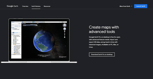
Google Earth Pro is a geospatial tool developed by Google, shown as an interactive virtual globe that can be configured, rotated, magnified, and more, providing users with an updated satellite view of the Earth. This software enables users to collect “eye in the sky” images of the terrain below and gather and analyze geographic data for analysis, planning, and decision-making.
Google Earth Pro is utilized across multiple industries including real estate, construction, mining, military, law enforcement, and more. The software is so versatile that it can be utilized for a wide range of purposes. With the software, users can locate and outline properties, measure the land area for commercial development, and lay parcels and boundary lines.
Show MoreOverview of Google Earth Pro Benefits
Intuitive design
Google Earth Pro does not stymie its users, including those who are still new to the software. With its friendly design, it won’t take long before users get fully acquainted with Google Earth Pro’s interface and features. People are more than encouraged to explore and experiment with their capabilities, eventually finding out how it can add value to their business organization.
Advanced set of features
Google Earth Pro is loaded with some of the most compelling features found in a mapping tool. It comes with advanced measurement capabilities, exclusive pro data layers, high-resolution printing, GIS import, spreadsheet import, and even a movie maker.
With all these impressive tools, users can: compute areas and distances with near-perfect accuracy; create video content like slideshows for presentation and analysis; map addresses in a few clicks, and; print high-resolution images to supplement reports, pitches, and presentations.
Usable for any industry
With powerful data visualization tools, advanced measurements, and other features, Google Earth Pro makes it easy for businesses across various sectors to make data-driven reports and presentations, compelling pitches, and come to better, smarter business decisions. From planning site developments to locating specific properties to creating a video to showcase a holiday tour, Google Earth Pro is a perfect mapping solution for every industry.
Show MoreOverview of Google Earth Pro Features
- Geographic Data Capture and Management
- 2D and 3D Data Visualization
- Map Creation
- Geocoding
- Data Publishing
- Overlaying
- Buffer Zone Query
- Spatial Analysis
- Moviemaker
- Real-Time Streaming
- Reporting
Google Earth Pro Position In Our Categories
Because businesses have distinct business wants, it is reasonable that they abstain from purchasing an all-encompassing, ideal system. Having said that, it would be almost impossible to try to stumble on such an app even among popular software products. The logical thing to do would be to tabulate the various major factors that demand careful thought like major features, budget, technical skill capability of staff, business size, etc. After which, you should do the product research thoroughly. Read some Google Earth Pro analyses and scrutinize the other software programs in your list in detail. Such well-rounded product investigation ensures you circumvent ill-fitting applications and choose the one that offers all the aspects your company requires for success.
Position of Google Earth Pro in our main categories:
TOP
20
Google Earth Pro is one of the top 20 GIS Software products
If you are considering Google Earth Pro it might also be beneficial to examine other subcategories of GIS Software collected in our database of SaaS software reviews.
Every enterprise has its own characteristics, and might require a particular type of GIS Software solution that will be fit for their company size, type of clients and staff and even individual niche they cater to. You should not count on getting an ideal app that is going to be suitable for every company no matter what their history is. It may be a good idea to read a few Google Earth Pro GIS Software reviews first and even then you should pay attention to what the service is intended to do for your business and your staff. Do you need an easy and straightforward solution with only essential functions? Will you really use the complex tools needed by experts and large enterprises? Are there any specific tools that are especially beneficial for the industry you operate in? If you ask yourself these questions it is going to be much easier to find a reliable software that will fit your budget.
How Much Does Google Earth Pro Cost?
Google Earth Pro Pricing Plans:
Free Trial
Google Earth Pro
Free
What are Google Earth Pro pricing details?
Google Earth Pro Pricing Plans:
Free Trial
Google Earth Pro
Free
Google Earth Pro is free. Contact the vendor for enterprise pricing information of their other products.
User Satisfaction
Positive Social Media Mentions
1023
Negative Social Media Mentions
123
We know that when you decide to purchase a GIS Software it’s crucial not only to see how experts rank it in their reviews, but also to check whether the actual people and businesses that use this software are genuinely satisfied with the service. Because of that need we’ve designer our behavior-based Customer Satisfaction Algorithm™ that gathers customer reviews, comments and Google Earth Pro reviews across a broad range of social media sites. The data is then featured in a simple to understand form indicating how many users had positive and negative experience with Google Earth Pro. With that information available you should be ready to make an informed buying choice that you won’t regret.
Video
Technical details
Devices Supported
- Web-based
Deployment
- Cloud Hosted
Language Support
- English
Pricing Model
- Free
Customer Types
- Small Business
- Large Enterprises
- Medium Business
What Support Does This Vendor Offer?
- phone
- live support
- training
- tickets
What integrations are available for Google Earth Pro?
Google Earth Pro can integrate with lots of mapping and data visualization tools:
- LandVision
- RealDesk
- Nearmap
- CalTopo
- ArcGIS
- DATA-Viu
Google Earth Pro User Reviews
Google Earth Pro average rating:
4/5
Overall impression
5/5
Customer Support
4/5
Value for Money
4/5
Ease of Use
Write your own review of this product
ADD A REVIEWThe most favorable review
PROS: High-resolution satellite images that can be accessed through this software have played a large part in my research. Google Earth Pro also has 3D image viewing and buffer features which are both helpful for exploring locations.
CONS: It would be more convenient to use for research if geospatial data can be downloaded from it directly.
The least favorable review
PROS: Google Earth Pro is a great tool for collecting geospatial data. It works well with other GIS applications like GRASS GIS and QGIS. It is easy to navigate and is packed with features that allow you to configure searches and assess locations. It also has versions that support different devices which makes it more accessible for users.
CONS: Poor internet connection will result in problems in accessing and using Google Earth Pro.
More reviews from 14 actual users:
Sort by:
Latest
- Latest
- Most useful
- Most positive
- Most negative
Comes in an awesome mobile version
Read full review >
4/5
Overall impression
3/5
Customer Support
4/5
Value for Money
3/5
Ease of Use
Published on: 13.11.2021
Company Size: More than 100 Employees
Industry: Oil & Energy
PROS: Google Earth Pro has awesome features for cartography, geospatial data gathering, and coordinate searching. It comes with a mobile version that allows for greater efficiency and better navigation control than the web and desktop versions.
CONS: I sometimes encounter program errors on the mobile version. Its 3D imagery, as well as its general stability, could be improved.
Give you access to high-quality satellite images
Read full review >
4/5
Overall impression
3/5
Customer Support
4/5
Value for Money
3/5
Ease of Use
Published on: 31.10.2021
Company Size: More than 100 Employees
Industry: Architecture & Planning
PROS: Google Earth Pro is an ideal solution for professionals who need access to virtual ocular visits to different areas. This software is extremely user-friendly and is equipped with various helpful tools for viewing 3D imagery, exporting data, and measuring distances. It is also packed with powerful searching capabilities and drawing and mapping features.
CONS: I have not encountered any major issues with regard to the use of Google Earth Pro. The program has run smoothly in my experience.
An indispensable tool for GIS analysis
Read full review >
4/5
Overall impression
3/5
Customer Support
3/5
Value for Money
3/5
Ease of Use
Published on: 25.09.2021
Company Size: More than 100 Employees
Industry: Civil Engineering
PROS: Google Earth Pro has great features that allow me to explore and keep images of areas that are relevant to my profession. It is a very user-friendly software and it comes with an awesome support team as well. I have been using it for some time now and it has been extremely useful for me.
CONS: Google Earth Pro could be improved with more up-to-date versions of satellite images and higher resolution of zoomed out versions.
Perfect for viewing satellite images
Read full review >
4/5
Overall impression
3/5
Customer Support
3/5
Value for Money
4/5
Ease of Use
Published on: 23.09.2021
Company Size: 1-10 Employees
Industry: N/A
PROS: Google Earth Pro can be used in Street View mode. It is extremely useful for locating buildings.
CONS: This software is not lightweight. I would like it better if there is a way to access it without an internet connection.
A user-friendly GIS tool
Read full review >
5/5
Overall impression
5/5
Customer Support
4/5
Value for Money
5/5
Ease of Use
Published on: 27.07.2021
Company Size: 1-10 Employees
Industry: Education
PROS: One of these GIS software’s advantage points is its historical imagery feature which comes handy for research. It is also fairly easy to learn how to navigate. It enables you to explore the world with its high-quality satellite images and use drawing tools to create paths or polygons.
CONS: I would like this software better if the scrolling feature would be improved and if it would be easier to change views. It can sometimes be hard to view the image in a perpendicular manner, especially when using a laptop touchpad. A view locking feature that would still allow for navigation would be an ideal solution for this issue.
A great platform for international students
Read full review >
4/5
Overall impression
3/5
Customer Support
4/5
Value for Money
3/5
Ease of Use
Published on: 14.05.2021
Company Size:
Industry: Education Management
PROS: This GIS tool is highly commendable for its high-resolution images.
CONS: I would appreciate this platform more if it can provide us with up-to-date satellite images of rural suburban areas.
I would highly recommend Google Earth Pro
Read full review >
5/5
Overall impression
4/5
Customer Support
4/5
Value for Money
5/5
Ease of Use
Published on: 09.04.2021
Company Size:
Industry: Automotive
PROS: Google Earth allows you to virtually inhabit spaces that you cannot reach in the physical sense. I have been using this to explore different places and I love my experience with using it so far.
CONS: It would be better if they have a database of cloud-free satellite images that would allow the users to view the earth in its entirety for specific periods of time.
We work more efficiently with this GIS tool
Read full review >
4/5
Overall impression
4/5
Customer Support
4/5
Value for Money
4/5
Ease of Use
Published on: 24.03.2021
Company Size:
Industry: Education Management
PROS: The high-quality satellite images in this software allow us to better identify buildings.
CONS: Google Earth Pro is a heavy resource tool. Its data requirement is expected of its nature though.
Best GIS tool for research
Read full review >
5/5
Overall impression
5/5
Customer Support
4/5
Value for Money
5/5
Ease of Use
Published on: 03.01.2021
Company Size: More than 100 Employees
Industry: Research
PROS: High-resolution satellite images that can be accessed through this software have played a large part in my research. Google Earth Pro also has 3D image viewing and buffer features which are both helpful for exploring locations.
CONS: It would be more convenient to use for research if geospatial data can be downloaded from it directly.
A powerful GIS tool
Read full review >
4/5
Overall impression
4/5
Customer Support
4/5
Value for Money
4/5
Ease of Use
Published on: 03.01.2021
Company Size: More than 100 Employees
Industry: N/A
PROS: Google Earth Pro is a powerful tool that you can use for mapping, collecting data, and planning. This software holds a large amount of geographic information. It is easily searchable and it comes with a lot of other features. It also works well with ArcGIS, GRASS GIS, QGIS, and other GIS tools.
CONS: This tool is highly reliant on fast and steady internet connection.
A GIS tool that makes mapping and planning a lot easier
Read full review >
4/5
Overall impression
3/5
Customer Support
3/5
Value for Money
3/5
Ease of Use
Published on: 12.03.2020
Company Size: More than 100 Employees
Industry: Civil Engineering
PROS: I gather geospatial data for processing on ArcGIS or QGIS from Google Earth Pro. This tool is an efficient solution for acquiring and editing specific geographic information. It can also be easily integrated with other GIS tools.
CONS: This tool would serve our planning needs better if its satellite images would be more up-to-date.
Google Earth Pro has a lot of great features
Read full review >
4/5
Overall impression
4/5
Customer Support
4/5
Value for Money
4/5
Ease of Use
Published on: 02.03.2020
Company Size: More than 100 Employees
Industry: Oil & Energy
PROS: Google Earth Pro is a great tool for collecting geospatial data. It works well with other GIS applications like GRASS GIS and QGIS. It is easy to navigate and is packed with features that allow you to configure searches and assess locations. It also has versions that support different devices which makes it more accessible for users.
CONS: Poor internet connection will result in problems in accessing and using Google Earth Pro.
Cost-effective mapping tool
Read full review >
5/5
Overall impression
5/5
Customer Support
5/5
Value for Money
5/5
Ease of Use
Published on: 02.03.2020
Company Size: More than 100 Employees
Industry: Design
PROS: Google Earth Pro is the best mapping tool. It provides professionals with the most accurate geospatial data. It can also be easily integrated with other tools like ArcGIS and AutoCAD.
CONS: The only thing that is not working as well as expected for me is the Street View mode. It takes a while for the images to load in that setting so mapping out streets also take longer than is ideal.
The best GIS tool on the market
Read full review >
5/5
Overall impression
4/5
Customer Support
4/5
Value for Money
5/5
Ease of Use
Published on: 28.02.2020
Company Size: More than 100 Employees
Industry: N/A
PROS: Google Earth Pro is an indispensable tool for professionals who deal with geospatial data. It is the most accurate source of maps, 3D images, and coordinates. Its 3D maps are particularly helpful for assessing locations and the surrounding areas. It can also be used for exploring places in Street View mode.
CONS: This software relies heavily on a fast internet connection. Its performance and image resolution would not be as good with slow data speeds.


Join a community of 7,369 SaaS experts
Thank you for the time you take to leave a quick review of this software. Our community and review base is constantly developing because of experts like you, who are willing to share their experience and knowledge with others to help them make more informed buying decisions.
Sign in with LinkedIn
Why we require LinkedIn?
- Show the community that you're an actual user.
- We will only show your name and profile image in your review.
- You can still post your review anonymously.
OR
Sign in with company emailSign in with company email
Popular Google Earth Pro Alternatives
Top Competitors To Google Earth Pro By Price
Product name:
Price:
Trending GIS Software Reviews
Google Earth Pro Comparisons
Product name:
Google Earth Pro user reviews
Comes in an awesome mobile version
Read full review >
4/5
Overall impression
3/5
Customer Support
4/5
Value for Money
3/5
Ease of Use
Published on: 13.11.2021
Company Size: More than 100 Employees
Industry: Oil & Energy
Give you access to high-quality satellite images
Read full review >
4/5
Overall impression
3/5
Customer Support
4/5
Value for Money
3/5
Ease of Use
Published on: 31.10.2021
Company Size: More than 100 Employees
Industry: Architecture & Planning
An indispensable tool for GIS analysis
Read full review >
4/5
Overall impression
3/5
Customer Support
3/5
Value for Money
3/5
Ease of Use
Published on: 25.09.2021
Company Size: More than 100 Employees
Industry: Civil Engineering
Perfect for viewing satellite images
Read full review >
4/5
Overall impression
3/5
Customer Support
3/5
Value for Money
4/5
Ease of Use
Published on: 23.09.2021
Company Size: 1-10 Employees
Industry: N/A
A user-friendly GIS tool
Read full review >
5/5
Overall impression
5/5
Customer Support
4/5
Value for Money
5/5
Ease of Use
Published on: 27.07.2021
Company Size: 1-10 Employees
Industry: Education

Page last modified

Did you find this review useful?
Yes
No
Thank you for your feedback
How can we make this page better?
Unsure about this software?
FIND ALTERNATIVES