- Home
- GIS Software
- GeoServer
GeoServer Review

What is GeoServer?
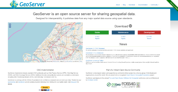
GeoServer is one of the most popular and most flexible Java-based software servers when it comes to viewing and editing geospatial data. The software is made for interoperability and it is capable of publishing data from spatial data sources such as WMS, WFS, WCS, WPS, and REST. Lastly, GeoServer uses Open Geospatial Consortium as a standard basis.
The product caters to those who are looking to create highly detailed maps. On that matter, you can create maps in a variety of output formats through GeoServer.
What makes GeoServer a cut above the rest is that it’s a modular application that you can expand via extensions. These extensions allow for a selection of processing options which makes your data freer for viewing and editing.
Show MoreOverview of GeoServer Benefits
OGC Standards
GeoServer is based on the standards set by the Open Geospatial Consortium (OGC). The OGC is an organization comprised of over 400 commercial, governmental, and research organizations that encourages the development of open standards for data sharing, andGIS data processing.
Flexible Formatting
You can use various formats when using GeoServer as the software is highly flexible. Its compatible formats include PostGIS, Oracle Spatial, ArcSDE, DB2, MySQL, MongoDB, Apache Soir, Shapefiles, GeoTIFF, GTOPO30, ECW, MrSID, JPEG2000.
Detailed Map Making
GeoServer comes integrated with OpenLayers, a free mapping library. This allows map generation to be intuitive and fast at the same time. Aside from being capable of creating detailed maps, GeoServer is also capable of creating maps in various output formats making them more accessible to others.
Intensive Data Sharing
Since GeoServer is Open Source, the data you help create will be freer. You can easily enable others to use your data into their websites or applications with greater transparency.
Map Compatibility
Beyond map creating, GeoServer also allows you to share your data with other mapping applications. It’s compatible with the top names including Google Maps, Google Earth, Microsoft Bing Maps, and MapBox. Lastly, it can also connect with certain GIS architectures like ESRI ArcGIS.
Commercial Support
GeoServer has been a long-standing project. That being said, it has garnered the support of various organizations for commercial benefits. Its commercial support includes Planet Federal, Astun Technology, GeoSolutions, Alcante, and GeoCat.
Show MoreOverview of GeoServer Features
- Community Modules
- Oracle Database Connection
- Code Review
- Community Support
- User Guide
- Developer Docs
- Tutorials For JNDI, WMS, & CQL
GeoServer Position In Our Categories
Because companies have unique business-related needs, it is only rational that they avoid paying for a one-size-fits-all, ”best” software product. Still, it would be almost impossible to try to chance on such an app even among well-known software products. The efficient step to do is to narrow down the different important aspects that demand research including critical features, plans, technical skill aptitude of staff members, business size, etc. Thereafter, you must double down on the product research comprehensively. Go over some GeoServer evaluations and look over each of the software options in your list more closely. Such detailed product research makes sure you stay away from mismatched software solutions and buy the one which offers all the function your company requires.
Position of GeoServer in our main categories:
TOP
50
GeoServer is one of the top 50 GIS Software products
If you are considering GeoServer it may also be beneficial to investigate other subcategories of GIS Software listed in our database of SaaS software reviews.
Since each enterprise has particular business needs, it is sensible for them to refrain from looking for a one-size-fits-all faultless software system. Needless to say, it would be useless to try to find such an app even among market-leading software applications. The smart thing to do would be to catalog the various essential aspects that require consideration such as key features, budget, skill levels of workers, company size etc. Then, you should do your homework thoroughly. Read some GeoServer GIS Software reviews and look into each of the other systems in your shortlist in detail. Such comprehensive research can make sure you weed out ill-fitting applications and select the solution that presents all the features you need for business success.
How Much Does GeoServer Cost?
GeoServer Pricing Plans:
Free Trial
GeoServer
Free
What are GeoServer pricing details?
GeoServer Pricing Plans:
Free Trial
GeoServer
Free
GeoServer is an open-source product so you can use the software free of charge. Enterprising pricing is not available.
User Satisfaction
Positive Social Media Mentions
59
Negative Social Media Mentions
1
We realize that when you choose to purchase a GIS Software it’s important not only to see how professionals score it in their reviews, but also to discover whether the real users and companies that use it are indeed content with the service. Because of that need we’ve designer our behavior-based Customer Satisfaction Algorithm™ that gathers customer reviews, comments and GeoServer reviews across a broad range of social media sites. The information is then featured in an easy to understand form revealing how many customers had positive and negative experience with GeoServer. With that information at hand you will be prepared to make an informed buying decision that you won’t regret.
Technical details
Devices Supported
- Windows
- Linux
- Mac
Deployment
- On Premise
Language Support
- English
Pricing Model
- Free
Customer Types
- Small Business
- Medium Business
What Support Does This Vendor Offer?
- phone
- live support
- training
- tickets
What integrations are available for GeoServer?
No information available.
GeoServer User Reviews
GeoServer average rating:
4/5
Overall impression
5/5
Customer Support
4/5
Value for Money
4/5
Ease of Use
Write your own review of this product
ADD A REVIEWThe most favorable review
PROS: Oftentimes, tools such as google maps aren't enough to deal with geospatial data and customized display information. Accessing various databases to extract data that can be viewed conveniently within the map is challenging. GeoServer improved all that by enabling connectivity between maps and databases through the settings menu. It also allows embedding and accessing of maps from any program using SDKs as OpenLayer for web applications. I also really liked its comprehensive report and its collaboration with various databases.
CONS: As a developer, setting up the server is a little challenging because you should know things about apache tomcat. Also, you need to purchase the cloud-based version of GeoServer to be able to use it. I think that it would be nice to have a free version to test it out first and build proof of concepts.
The least favorable review
PROS: Oftentimes, tools such as google maps aren't enough to deal with geospatial data and customized display information. Accessing various databases to extract data that can be viewed conveniently within the map is challenging. GeoServer improved all that by enabling connectivity between maps and databases through the settings menu. It also allows embedding and accessing of maps from any program using SDKs as OpenLayer for web applications. I also really liked its comprehensive report and its collaboration with various databases.
CONS: As a developer, setting up the server is a little challenging because you should know things about apache tomcat. Also, you need to purchase the cloud-based version of GeoServer to be able to use it. I think that it would be nice to have a free version to test it out first and build proof of concepts.
More reviews from 3 actual users:
Sort by:
Latest
- Latest
- Most useful
- Most positive
- Most negative
I had a great user experience with this tool.
Read full review >
4/5
Overall impression
3/5
Customer Support
4/5
Value for Money
3/5
Ease of Use
Published on: 09.11.2021
Company Size: More than 100 Employees
Industry: Higher Education
PROS: Oftentimes, tools such as google maps aren't enough to deal with geospatial data and customized display information. Accessing various databases to extract data that can be viewed conveniently within the map is challenging. GeoServer improved all that by enabling connectivity between maps and databases through the settings menu. It also allows embedding and accessing of maps from any program using SDKs as OpenLayer for web applications. I also really liked its comprehensive report and its collaboration with various databases.
CONS: As a developer, setting up the server is a little challenging because you should know things about apache tomcat. Also, you need to purchase the cloud-based version of GeoServer to be able to use it. I think that it would be nice to have a free version to test it out first and build proof of concepts.
Amazing!
Read full review >
4/5
Overall impression
4/5
Customer Support
3/5
Value for Money
4/5
Ease of Use
Published on: 01.05.2021
Company Size: More than 100 Employees
Industry: Research
PROS: I like that I can do WMS Publishing with various forms in GeoServer.
CONS: I can't locate the source of error.
GeoServer, an open-source tool unique from ArcGIS.
Read full review >
4/5
Overall impression
4/5
Customer Support
4/5
Value for Money
4/5
Ease of Use
Published on: 22.02.2020
Company Size: 1-10 Employees
Industry: Aviation & Aerospace
PROS: Free software that enables me to develop and configure stuff according to my preferences.
CONS: Data protection and technical support are the 2 missing elements. ArcGIS Server provides all these at a reasonable price.


Join a community of 7,369 SaaS experts
Thank you for the time you take to leave a quick review of this software. Our community and review base is constantly developing because of experts like you, who are willing to share their experience and knowledge with others to help them make more informed buying decisions.
Sign in with LinkedIn
Why we require LinkedIn?
- Show the community that you're an actual user.
- We will only show your name and profile image in your review.
- You can still post your review anonymously.
OR
Sign in with company emailSign in with company email
Popular GeoServer Alternatives
Top Competitors To GeoServer By Price
Product name:
Price:
by quote
by quote
Trending GIS Software Reviews
8.8
100%
GeoServer Comparisons
Product name:
GeoServer user reviews
I had a great user experience with this tool.
Read full review >
4/5
Overall impression
3/5
Customer Support
4/5
Value for Money
3/5
Ease of Use
Published on: 09.11.2021
Company Size: More than 100 Employees
Industry: Higher Education
Amazing!
Read full review >
4/5
Overall impression
4/5
Customer Support
3/5
Value for Money
4/5
Ease of Use
Published on: 01.05.2021
Company Size: More than 100 Employees
Industry: Research
GeoServer, an open-source tool unique from ArcGIS.
Read full review >
4/5
Overall impression
4/5
Customer Support
4/5
Value for Money
4/5
Ease of Use
Published on: 22.02.2020
Company Size: 1-10 Employees
Industry: Aviation & Aerospace

Page last modified

Did you find this review useful?
Yes
No
Thank you for your feedback
How can we make this page better?
Unsure about this software?
FIND ALTERNATIVES